Our Office
Holt Hall, Rooms 138, 141, 157
530-898-5205
jrotnem@csuchico.edu
Regular Hours
8 a.m.–5 p.m. (Monday–Friday)
Mailing Address
Center for Water & the Environment
400 W. First St.
Chico, CA 95929–0555
Big Chico Creek Water Quality Monitoring
Main | Data Table | Temperature | Electrical Conductivity | pH | Dissolved Oxygen | Turbidity | Nutrients | Metals
Disclaimer: Data presented on this webpage were acquired following internal (non-standard) procedures and are therefore for information purposes only and not citable until independent peer review and publication.
Overview
The goal of this project is to observe the influence of land use and environmental changes, such as drought, fires, and urban runoff through long term monitoring of major water quality characteristics of Big Chico Creek. Data acquisition began in Spring 2021 and datasets will be updated as new data are made available. Over time, the project will develop a multi-year data base to be used by students and faculty for future studies that may occur within the Big Chico Creek watershed. This webpage is made available by faculty and students from California State University Chico and the Center for Water and the Environment. Data may be obtained and uploaded from measurements conducted along Big Chico Creek.
Introduction
Big Chico Creek watershed layout (PDF). Map created by the Center for Water and the Environment for the Big Chico Creek Watershed Tour.
 Big Chico Creek originates from springs on Colby Mountain at an elevation of 5400 feet and flows about 45 miles until its confluence with the Sacramento River. The Big Chico Creek watershed resides in a Mediterranean climate with wet, cool winters and hot, dry summers. At high elevations, the vegetation within the watershed transitions from mixed fir and Ponderosa pine to California mixed conifer, oak woodland, and grasslands at lower elevations. The creek is characterized by steep canyons in the upper watershed as it flows through the Tuscan and Chico formations. These geologic formations serve as the main recharge zone for the watershed and Butte Basin aquifer. Yearly precipitation ranges from 20 inches to 70 inches throughout the watershed. Average baseflow is around 35 cubic feet per second (cfs) and peak storm flow can reach up to 15,000 cfs. During the hot, dry months of July to September, the creek typically loses surface flow in town and does not reach the Sacramento River.
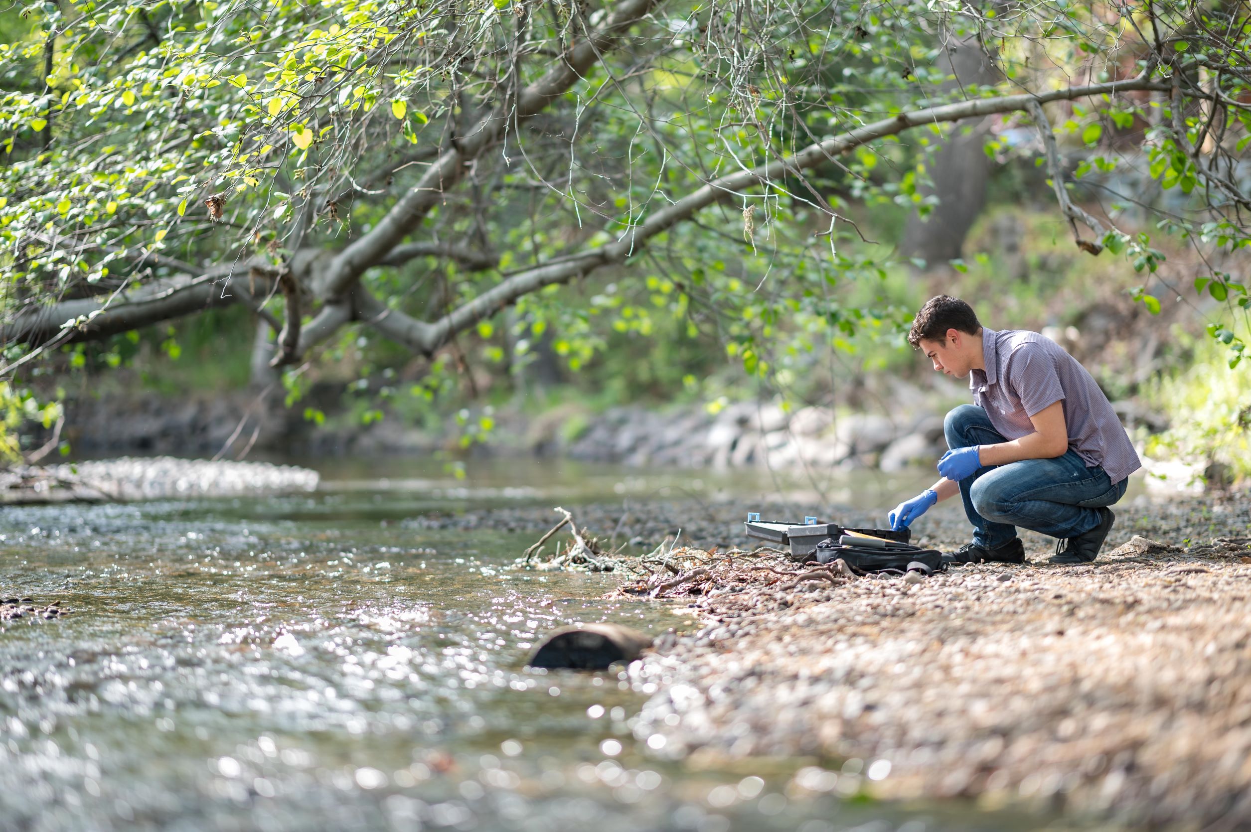
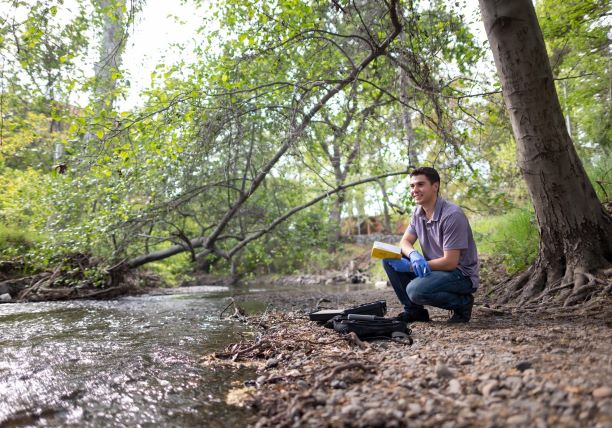
Data acquisition began in March 2021 and sampling is anticipated to occur about twice a month until July 2022. Primary water quality parameters include temperature, turbidity, dissolved oxygen, pH, electrical conductivity, nitrate, and phosphate. Streamflow data is acquired from the Department of Water Resources California Data Exchange Center.
Resource: Big Chico Creek Watershed Project. (accessed March 2021). Big Chico Creek Watershed Existing Conditions Report. Big Chico Creek Watershed Alliance. https://www.csuchico.edu/bccer/_assets/documents/bigchicocreekwatershed-ecr.pdf
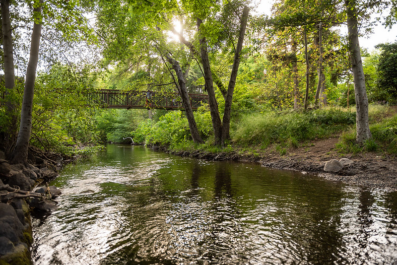
Sampling Location
The sampling site on the Chico State campus is located at 39.730368N 121.845753W.
Future Goals
 Future goals of the project are to continue monitoring and add more sampling locations. We look forward to having increased participation from students and faculty!
In the near future, we plan to start constant monitoring at the Big Chico Creek Ecological Reserve and at the confluence with the Sacramento River. Additional parameters to include with the monitoring project are stage and indicators of pathogenic bacteria (total coliforms and E. coli.)
Acknowledgements
This project was supported primarily by the 2021-22 University Foundation Governors’ Award (Student-Run Water Quality Laboratory). Additional sources of funding include the 2020-21 Student Learning Fee Award (Experiential Learning of the Big Chico Creek Watershed), and the Gateway Science Museum, recipient of the 2021 Citizen Science, Civics, and Resilient Communities Award, for Brooke Rosenow. Metal analyses were funded by NSF Instrumentation and Facilities grant EAR-1826807. We gratefully acknowledge all undergraduate and graduate students who have worked on this project and continue to do so. Thank you to Chico State's university photographer, Jason Halley. For direct questions regarding use of data or future participation, please contact Dr. Sandrine Matiasek (smatiasek@csuchico.edu(opens in new window)) or Dr. Jackson Webster (jwebster13@csuchico.edu(opens in new window))