
Our Office
BCCER
3521 14 Mile House Road
Forest Ranch, CA 95942
530-898-5010
530-898-5011
Mailing Address
BCCER/Chico State Enterprises
25 Main St. Suite 203
Chico, CA 95928-5388


The Big Chico Creek Watershed
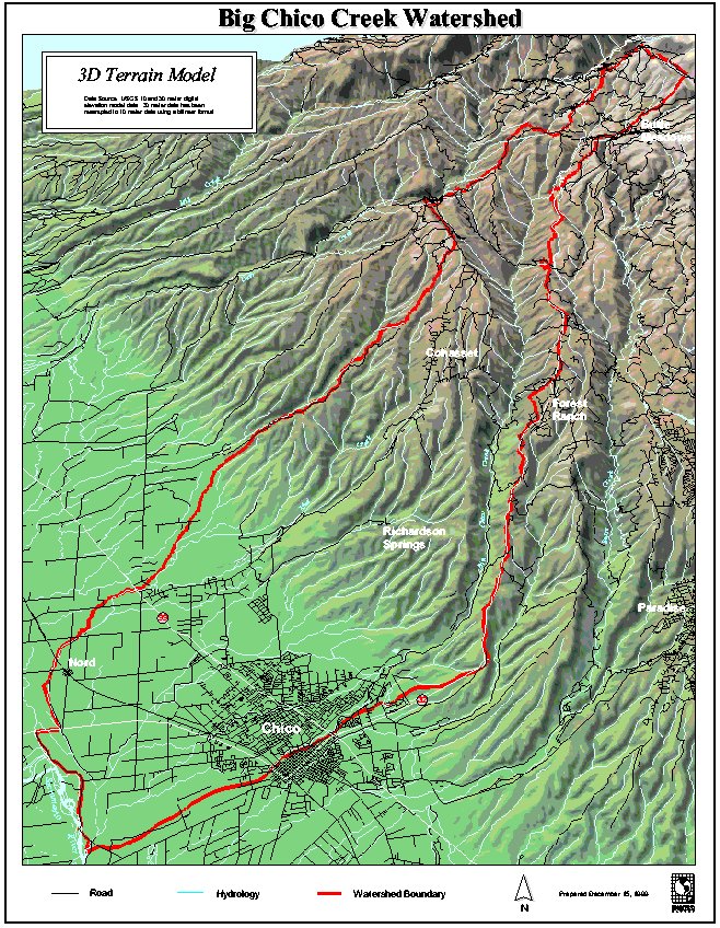 Big Chico Creek originates on Colby Mountain and flows 45 miles to its confluence with the Sacramento River. Watershed elevation ranges from about 120 feet at the mouth to 6000 feet on Colby Mountain. Mean precipitation ranges from 25 inches in the valley to 80 inches in the headwater region, where much of it falls as snow. Because of the precipitation gradient, the majority of the flow of Chico Creek enters in the upper third of the drainage. At base flow, discharge increases in a downstream direction from the headwater to the Sacramento Valley. Typical base flow in the region of the Big Chico Creek Ecological Reserve would be around 30 cubic feet per second (cfs). Peak flood flow might be as much as 15,000 cfs. In summer, as the creek flows across its out-wash delta and the valley floor, water is lost rapidly to infiltration so that, during many summers, no surface flow reaches the Sacramento River.
Vegetation at higher watershed elevations is dominated by mixed conifer forests. These gradually change along the precipitation gradient to chaparral, oak woodland and finally grassland. Fire, logging, and grazing are major forces affecting the watershed. Urban and suburban development are increasing factors.
Much more information about the Big Chico Creek watershed can be found in the Existing Conditions Report. (PDF) The Big Chico Creek Ecological Reserve lies entirely within the Big Chico Creek Watershed.