Our Office
BCCER
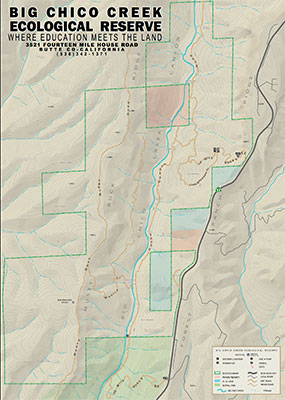
3521 14 Mile House Road
Forest Ranch, CA 95942
530-898-5010
530-898-5011
Mailing Address
BCCER/Chico State Enterprises
25 Main St. Suite 203
Chico, CA 95928-5388


BCCER Maps
BCCER Google Map: http://tinyurl.com/DirectionsToBCCER
Further Directions: Coming from Chico east on HWY 32, you will pass Crown Point Road on the right. In about a mile, on the left you will see a chain link fence, a turnout, then our driveway, marked solely with a small green sign with our address - 3521. There is a small parking area just down the hill at the gate. If you have made prior arrangements, follow the road down to the field office. If you reach 14 Mile House Road on your right, or any part of Forest Ranch, you have gone too far. (Navigation programs often lead people astray, so for best results, follow the map and directions above!)
- General Area Map (PDF)
- Hunt Map (PDF)
- Nature Trail (PDF)
- Soils Map (PDF)
- Also check out the Web Soil Survey(opens in new window) interface on the USDA Natural Resources Conservation Service web page
- Vegetation Map (JPG)
- 14 Mile House Road(opens in new window) (Google Maps)
If you require this information in an accessible format, please contact the Office of Accessible Technology at 530-898-6532.