
MYana Explorer - Discover an Eroded Volcano
Put on your hiking boots and thinking caps! Download the MYana Explorer app(opens in new window) and embark on a self-guided hike to discover evidence for the construction and erosion of Mt. Yana volcano through a geologist's perspective. MYana Explorer guides you on a 4 mile GPS tour to explore the interior of an eroded volcano and discover processes that build volcanoes and contribute to their erosion. Discover ways geologists unravel long term processes that take millions of years. The observation of such long-term processes gives you the opportunity to consider the geologic events associated with the construction and destruction of a once massive volcanic edifice. The app was constructed by an interdisciplinary group of students from California State University, Chico.
MYana Explorer:
- Guides you through an ancient eroded volcano
- Engages you with educational geological content
- Highlights eight stops equipped with images and guided activities
- Will be available on Google Play at no cost

The MYana Explorer app provides information about the construction and erosion of the Mt. Yana stratovolcano with interactive maps and images. Images courtesy of Google Maps and Dr. Rachel Teasdale
About Mt. Yana
Located just south of Lassen Volcanic National Park and an hour and 15 minute drive from Chico, the Mt. Yana Volcanic Center includes the eroded remnants of the eroded remnant of a stratovolcano. Mt. Yana was active approximately three million years ago as part of the ancient Cascades arc. Most hikers would not recognize this area is an eroded volcano. MYana Explorer is unique because it introduces you to the geology of the area and guides you in discovering processes that contributed to the construction and erosion of the volcano. This includes:
- Views of Mt. Shasta and Lassen Peak
- Three million-year-old lava flows
- Feeder dikes that transported magma during eruptions
- Debris flows that contributed to the erosion of Mt. Yana
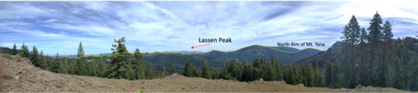
Panoramic photo of a view that shows the ancient shape of Mt. Yana peak. Images courtesy of Dr. Rachel Teasdale
Plan your adventure
When planning your MYana Explorer trip:
- Take a high-clearance vehicle the last mile of road to access the trailhead is unpaved and rocky
- Pack water, food, sunscreen, and a phone/camera
- The nearest restrooms are at the Cherry Hill Campground(opens in new window) on Humboldt Road
- Bring masks to wear and social distance to be safe during the COVID-19 pandemic, check the CDC(opens in new window) for official guidelines
- Remember to Leave No Trace(opens in new window), only footprints
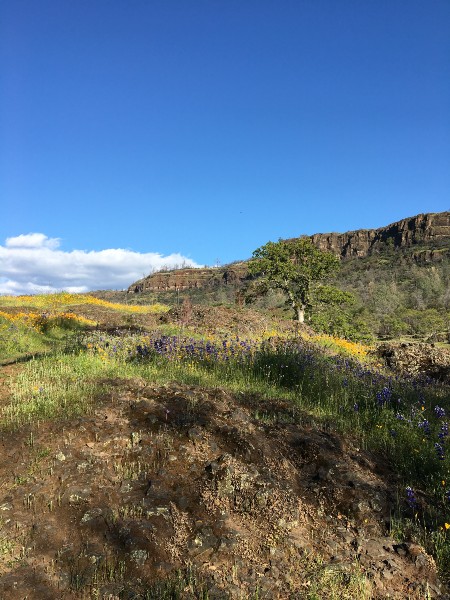
Images courtesy of Henry Marine
People behind the app
The research and creation of the MYana Explorer app is generously supported by Chico native, Charles Copeland. His family’s mountain property in Jonesville led to many trips through the Mt. Yana area. Copeland was thrilled to learn this region is home to an eroded volcano. He reached out to Dr. Rachel Teasdale with the idea for the app, to share his appreciation for geology and natural history.

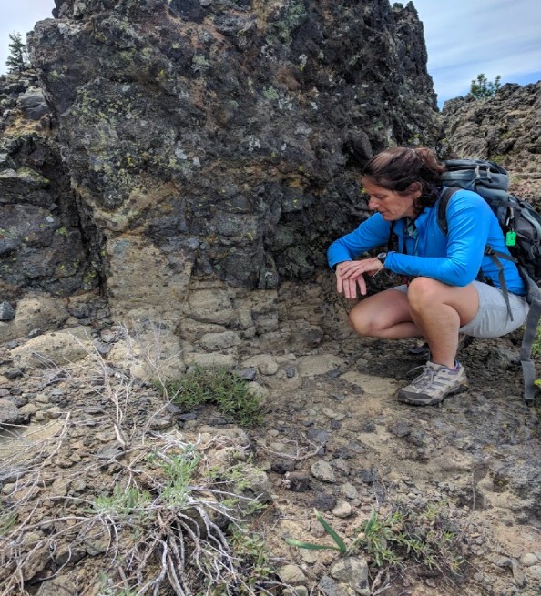
Earth and Environmental Sciences student Heidi Reynaga examines rock samples on the MYana Explorer app trail. Image courtesy of Dr. Rachel Teasdale
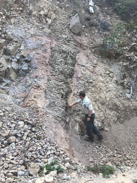
On the left is Dr. Teasdale at a stop on the MYana app. To the right is Quinn Little examining a dike through which magma was transported in Mt. Yana. Images courtesy of Dr. Rachel Teasdale.
App Developers
Project coordinators: Charles Copeland, Rachel Teasdale, Jeff Underwood, and Debra Johnson
Geologic history of Mt. Yana: Amy Robson, Evan Davis, Tim Wright, Quinn Little, Henry Marine, and Heidi Reynaga (Earth & Environmental Sciences); Dr. Mike Clynne, USGS
App coding and graphic design: Austin Schmidt, Jacob Gildea, Trevor Davis, and Atley Sakamoto (Computer Animation and Gaming Development)
Public Relations: Erin Harris and Sara Alise (Journalism and Public Relations)